Last year, I drove a week-long loop through Northeastern California to Crater Lake and back. However, I felt that I rushed the return. In early August, I decided to visit the area between Mount Shasta and Mount Lassen in a more leisurely manner. Of course, there are photos of the trip.

I started the trip late on Monday morning heading up I-5 about 200 miles to Redding, California. After checking in at my motel, I headed over to Turtle Bay to visit Spanish architect Santiago Calatrava’s Sundial Bridge.

Tuesday morning, I drove to Shasta Dam, a key component of California’s water and power infrastructure. The Bureau of Reclamation conducts tours through the dam and power station showcasing the structure and exploring its history. A bit of security theater happens during tour. You are allowed to bring a cell phone and camera, but all other electronic devices (e.g., Apple Watch) needed to be left back in your car on the other side of the dam. I also noted that a security guard followed the group to assure that no one stayed behind. From the dam, I also got my first views of Mount Shasta towering over the surrounding countryside.

The trip really started as I left the dam and returned to I-5 at the town of Shasta Lake. I had the best lunch of the trip, a BLT with smoked salmon on ciabatta at the Dunsmuir Brewery Works in the old center of town. On the way out of town, I stopped for a short hike down to Hedge Creek Falls. I-5 was actually rerouted to preserve the falls. I then finished the day at the hotel in the old lumber company town of McCloud, which I had visited last year.

The key attraction at McCloud is a set of 3 waterfalls on the McCloud River. Last year, I rushed by them in late afternoon. This year, I allocated most of Wednesday to visiting them. I hiked the trail along the river from the Lower Falls to the Middle Falls and up switchbacks to the rim of the canyon and a view down to the falls. I then hiked below the edge of the rim and across a slide to the Upper Falls. I returned via a road that connects the trailheads.

After spending a second night at the McCloud Hotel, I headed to Burney Falls at McArthur-Burney State Park. The falls were saved from the loggers and dammers and deeded to the state in the early twentieth century, before the state park system was created. Not only does the surface flow of Burney Creek pour over the rock-face, but rock-face actually weeps from the subsurface flow of the creek.

That evening, I continued to my overnight stop in Fall River Mills. On the way, I noticed that the main highway toward Lassen Volcanic National Park was closed due to a fire. The main scenic attraction on this drive was a view from the highway of the Pit River Falls. The Pit River rises in the far northeastern corner of California as a tributary to the Sacramento River, whose outlet to the Pacific Ocean is the Golden Gate. Anyway, the next morning, I found out that the fire was a minor affair, but was right next to the highway, necessitating the closure. A few miles south of the Highway 299-Highway 89 junction, I did observe fire crews snuffing out the remains of the fire.

Continuing down the road, I stopped and hiked through the Subway Cave at Old Station. The cave is actually a lava tube, formed when cooling surface lava hardened while hot lava continued to flow below. Eventually the flow drained, leaving the tube. I had brought a headlamp, and thus able to see my way through the tube.

A few miles past Old Station, I turned onto the road through Lassen Volcanic National Park. Snow had only been cleared from the road in late July. In fact, the most popular short trail in the park (Bumpass Hell) was still closed and only opened with hazard warnings a week after I left. I stopped at several spots through the park to experience much of the natural beauty, snow in late summer, and a boiling mud pot.

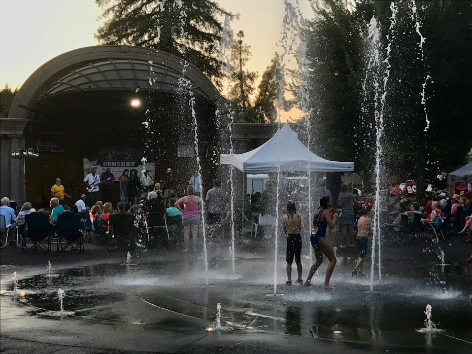
Finally, I descended back to the Sacramento Valley at Chico. The heat in the valley was stifling, even at 8pm. Some of the people attending an evening concert in the downtown plaza found relief in the fountain.The next day, I returned uneventfully to the Bay Area.
Food Notes: Great dinners and breakfasts at the Sage Restaurant in the McCloud Hotel. Also a great dinner at Crumbs Restaurant in McArthur (down the road from Fall River Mills).
Photo Notes: All photos were taken using an iPhone 7. There is an option to created a 3-second video with every photo. For selected photos, I was able to separate the video and those videos are presented throughout the photo galleries.
Auto Notes: I grabbed some fuel use statistics from the display in my 2016 Toyota Prius. In summary, mileage for the trip was 708.80 miles using 13.353 gallons of gas. Mileage was 53.08 mpg. I started the trip with a full tank of gas and made one gas station stop in McArthur in the Fall River Valley.

